A Photographic Jaunt Through Big Talbot and Fort George Island, Jacksonville, Florida

It’s day 2 of my photographic tour through Jacksonville, Florida. I’ve had four hours of sleep, and I’m moving quite slowly. I make my way downstairs in the hotel, and head out the front door to meet my tour guide, Will Dickey. Will is late, but this is not a problem since it is 4:45 AM, and I revel at the prospect of enjoying the serenity of this ungodly hour alone for a few minutes. However, instead of a peaceful, easy feeling as espoused by the Eagles, I find a car out in front with this dude blasting raucous, loud, and obnoxious rap music! He is gyrating in the front seat to an over-powering bass beat, while my head starts pounding. After about five minutes, he pulls away, and I am left in blessed relief. Subsequently, Will pulls up, and we are off on another photographic adventure.

We drive in the dark to Big Talbot Island State Park. This is a unique sea island, a preserve for nature study, bird-watching, and photography. As we pull into the parking lot, it is just starting to get light, the perfect time to get ready for our shoot. There is one car parked, a good indication that we will have the beach to ourselves. After a half-mile hike to the beach, we arrive with about 20 minutes until sunrise.

_G6A2176_AuroraHDR2019d.jpg

Big Talbot Island

This is Black Rock Beach, rife with gorgeous geologic formations and tree skeletons, having formed at the end of the last ice age about ten thousand years ago. The soil found on this beach is unique, being found in only three-four percent of land in this country. The black rock formations are composed of decayed leaves and compressed sand, some of the oldest in the world.

I set up and take my first photo as the sun rises. Time is of the essence, while the light and cloud formations are this good. However, my photographic bliss is just about to get adulterated by a photographer with a couple who have come on the scene to get wedding photos on this exquisite beach. They set up approximately thirty yards in front of me, quite presumptuous and a little irritating. Not to worry. Few things can ruin my good time here. I pick up and move down the beach to finish the shoot with about thirty minutes of good light to spare.

After downtime during the middle of the day, we wrap up in Fort George Island Cultural State Park. This area has been occupied by humans for five thousand years. Named for a garrison that was built in Seventeen Thirty-Six, Fort George Island became an area in which Native Americans feasted, and the opulent vacationed in the nineteen-twenties. The fort was built to defend Georgia’s southern flank when it was a colony.

The late afternoon sun is getting low in the sky, and we make our way to the Fort George Inlet.

_G6A2252_AuroraHDR2019b.jpg

Fort George Inlet

This is an access point for the Atlantic Intra-Coastal Waterway via the Fort George River. After surveying several sites, we settle on an area near a bridge as the sun is peaking underneath a cloud in its descent towards the horizon. Gentle rays of light line up across a sandbar in front of us. We take multiple shots before the sun disappears completely.

So ends my first full day in Jacksonville. After a beer and some dinner, I have to download my photos, recharge my camera batteries, count my insect bites, and get some sleep before my alarm rings for our morning shoot. I can only hope that rap psychopath sleeps in tomorrow morning.


A Trip to the Timucuan Ecological and Historic Preserve, Jacksonville, Florida

SARS-COV-2 has run rough-shod over my photographic travels over the last 15 months! In January of 2020, I planned trips to Scotland and Jacksonville, Florida for photography trips. However, in March of 2020, all plans were curtailed as Covid-19 spread, and I spent most of the time in isolation at home with my wife, or the office doing tele-visits with patients. However, I received the Pfizer vaccine at the end of December and again in January. At its peak, 3 million Americans a day were getting vaccinated, and the number of hospitalizations and deaths started to decline. My inclination towards travel resumed.

In April of 2021, I contacted Will Dickey, a professional photographer who lives in Jacksonville, Florida for the first time since the pandemic hit. I had read with interest an article that he had written in Outdoor Photographer Magazine about the many great sites to shoot around Jacksonville. After chatting with him on the phone, I made hotel reservations and went up there for a three day weekend.

_G6A2076b.jpg

Huguenot Pelican

It’s Friday in the late afternoon, and we arrive at the Huguenot Memorial Park. This area is a large beach on Black Hammock Island in the Timucuan Ecological and Historic Preserve in which archaeologists date human habitation to 2500 BC.

Will motors his 4-wheel drive vehicle for a fair distance down the beach to where no other cars are parked. While there are few people, numerous birds are frolicking around. This park was designated a Great Florida Birding Trail by the Florida Fish and Wildlife Conservation Commission. It is an important habitat for terns, shorebirds, and bar-tailed god-wits. We see gannets, loons, and sea ducks. My favorite species here are pelicans, one of which I photographed as shown above.

The sun is getting lower in the sky, so we hit the car and head to Saw Pit Creek. This area is very near to the George Crady Bridge Fishing Pier State Park. Some fishermen are calling it a day, and are hauling in their boats near the pier. Will and I are in luck. There are beautiful clouds in the sky, as the sun starts to set. This area is a marsh. I made the mistake of not bringing rubber boots, but not to worry, Will has an extra pair. We wade into the creek, set up our tripods and start to shoot.

_G6A2124_AuroraHDR2019b.jpg

Saw Pit Creek

We get several shots from different perspectives. All in all, I’ll have to say that the locations and weather have been excellent! We pull our tripods out of the mud, pack our cameras back up in our bags, and start to trudge out of the creek. There is one problem. My right foot sinks one foot into the marsh. This is just like quicksand as far as i am concerned. I can’t extricate my foot. Will has gotten ahead of me at this point, and has to make his way back to help pull me out of the muck. My jeans have now had it for the rest of the trip!

I love nature, travel, and photography. However, I can do without mud, ruined clothes and about one hundred insect bites all over my body! I guess this is just the cost of doing business in the world of outdoor photography. I’m looking forward to another shoot tomorrow with extra insect repellant applied.


Leesburg Bike-fest, Not to be Missed

Vroooom! There are not many things louder and more disruptive than multiple motorcycles passing me as I innocently drive down 441/27 on my way to Leesburg, Fl. I’m in Leesburg heading to work at Leesburg Regional Medical Center on a Friday late in April, but traffic is not moving. Strange looking people attired in bandanas, leather jackets, bearded men with tattoos, and women with piercings in various body parts, are all on the most incredible bikes Harley Davidson has to offer. They are all lined up, ready to enter the main drag into downtown Leesburg. I can’t wait to get out of work, grab my camera, and head to the Leesburg Bike-fest!

I make my way on foot towards the city center as choppers cruise past me in single-file, while parked bikes line the street on both sides. This is billed as “the World’s Largest 3-Day Motorcycle and Music Event.”

The festival had humble beginnings in 1997 when a community association consisting of Leesburg residents, business owners and government officials coalesced to form the Leesburg Partnership. They created a one-day event that was intended to attract visitors from all over Florida, with intent to promote local business. The 1997 venue was considered a success with 5000 motorcyclists, a few bands and vendors. By 2002, the event was expanded to 3 days and was gaining momentum. As of 2009, the festival had become the largest 3-day motorcycle and music event in the country. This extravaganza now brings in $286 million, attracting thousands of visitors to the area. The venue now encompasses 30 blocks with 55+ concerts, 200+ Vendors, and 6 Hot-body Contests.

Frankly, my senses are being stimulated on overload, Not knowing where to start, I decided to start cruising the side streets. Within one minute I come across three girls that are hard to miss. Having decided that I would like to photograph them, I start following them from behind, hoping to get a candid shot. With no warning, they stop, turn around, and ask me if I would like to grab a picture of them posing. Let me think. This is a no-brainer.

I go out on Main Street, park myself at a corner, and start shooting away. This is the most fun I’ve had since doing something similar in Madurai, India. Within five minutes, a guy on a bike pulls over to start talking to me. With his helmet and leather jacket on, I’m unprepared to see one of my fellow cardiologists, and yes, a biker, from Leesburg Regional Medical Center. He tells me, “There is more to life than cardiology.”

It’s now time to head to the Towne Square Stage where Twinkle Rock & Soul Radio have started their first set. I’ll have to say, it’s pretty loud around here'; my ears are ringing. This is one of at least 55 bands that will play at this festival over 3 days. At various squares and bars throughout Leesburg, there is no dearth of raucous rock and R&B to be heard.

After checking the event listings, I decided to come back Sunday morning for one of the Hot-body contests. Arriving early, I procure a spot right next to the stage which will allow me to photograph the girls as they appear. These ladies have won other competitions throughout the country, and are ready to try their luck at the Leesburg Bike-fest. Some of the contestants are Ms. Gator Harley, Ms. Pin-up, Ms. Ratmate and Ms. Budweiser. Each has a prescribed routine as they assume the stage individually. Walking to the front, they throw front and back poses to the crowd of onlookers who are drinking beer at 11:30 AM. From the front of the stage, they head towards the three judges at the back of the stage. I’ll have to say, this is more than my normal amount of entertainment on a Sunday morning.

I’ve reached the conclusion of the Leesburg Bike-fest for me this year. The sheer numbers of amazing motorcycles, bikers from all over the country, and locals having a good time eating, drinking and listening to live music has been quite a scene. I will be sure to mark the date of next year’s bike-fest on my calendar when I get home.


Going for Glaciers in Iceland

We’re cruising around Iceland in counter-clockwise fashion in our Mercedes 4x4. Dui, our guide and driver, tells us that today we are headed for a few of the glacier tongues of Vatnajokull, the largest in the country and possibly in all of Europe. Vatnajokull is so enormous that it has tongues large enough to have specific names. As we pull into the parking lot, that of Falljokall comes into view.

Vatnajokull is immensely popular because of its enormous size. It has become a national park, a magnet for tour groups and hikers. Fortunately, we are here in September after school has started and early enough to beat the crowds. We get out of the 4x4, unload our camera equipment, disburse, and head towards the glacier tongue.

As I lug my gear, my mind starts wandering. What exactly is a glacier? How do they form, and what makes them flow? What is global warming doing to the world’s glaciers?

It turns out that because of Iceland’s geographic location, the sea current causes climate characteristics that, over millennia, have created world-class glacier formations, including Vatnajokull.

Glaciers are masses of ice that flow slowly down mountains and valleys with extensive erosive capabilities. As they move, mountains are sculpted into jagged ridges, peaks and deep U-shaped valleys. These vast ice sheets are immensely thick, sometimes depressing the surface of the land below sea level in many locations.

Glacier formation requires more snow to accumulate in winter relative to the amount of meltwater in summer. As layers of snow are laid down, the snowflakes below come under tremendous pressure, expelling most of the air trapped between the grains. As a result, glacial ice forms. This process can take up to hundreds of years depending on the amount of snowfall.


Glaciers begin to flow when the ice along the base begins to melt. This occurs because the temperature at the base of the ice sheet increases due to the pressure of the overlying glacial ice. The temperature of the earth contributes to basal melting, the result of which is a lubricant that allows the glacier to slide over bedrock.

The scary thing about looking at and photographing these incredible natural structures is pondering the speed with which they are melting. Because of global warming, things that under normal circumstances happen in geologic time are now occurring over a human lifetime. This is the result of the burning of fossil fuels and the accretion of greenhouse gases in the atmosphere.

Well, it’s time to pack it in and head to our next photo-op. The world’s problems, including climate change, are not going to be solved today, or unfortunately, anytime soon. By photographing the glaciers of Iceland, I at least have a record of what they looked like in 2019 for my grandson to see someday.

Touring the Waterfalls of Iceland

It’s 4:00 AM. After all these years, I’ve made it to Iceland with a group of landscape photographers with the eager intention of photographing the waterfalls, mountains, lakes, rivers and volcanoes on this sub-arctic island. As my iPhone goes off, I’m disoriented, in a state of shock. This is not a vacation. It should more appropriately be referred to as photography boot camp!

_MG_5411d.jpg

At 4:45 AM we pile all our equipment into the Mercedes 4x4 and hit the road. Our guide and driver, Dui, an Icelandic professional photographer, tells us that we will be seeing some waterfalls today. Frankly, I do not do well at this time of morning with no coffee. The five others on the trip must feel similarly; everyone is quiet, but no one is going back to sleep.

As I sit in the 4x4 on our way to Aldeyjarfoss, Dui explains that Iceland has so many waterfalls due to the wet sub-arctic location we are in. Frequent rain and snow, together with large glaciers that melt on warmer days, all contribute to fast-flowing rivers. These give rise to a multitude of waterfalls on this island. There are said to be up to 10,000 waterfalls here when smaller water cascades over stone terraces are included.

We’ve reached Aldeyjarfoss as shown above. I can hear it before I see it! We get out of the Mercedes, grab our tripods from the back of the 4x4, and scatter in different directions looking for good vantage points to set up. Having reached an ideal ledge with tripod in place, I start what has become a learned procedure: test shot using live view to compose the photo, polarizing filter, then graduated neutral density filter, and finally the Little Stopper (6 stop neutral density filter). I experiment with slow shutter speeds to get the waterfall to appear silky smooth.

_MG_5374b.jpg

I love Aldeyjarfoss Waterfall. Watching the Skjalfandafljot River drop twenty meters into a cold, icy pool surrounded by basalt columns, is an awesome display of nature. We’ve hit it right today, with almost perfect lighting for photographic capture.

Our next stop is Godafoss, or “waterfall of the gods.” It’s given this name for good reason. Located in the Bardardalur District of the Northeastern Region, we can see the large horseshoe shape of the falls as we approach from the Sprengisandur Highland Road. My goal at present is to photograph the falls from both sides of a bridge that leads up to this enormous chute of water.

_MG_5272d-TP-B&W.jpg

Legend has it that in 1000 AD, the law speaker, Porgeir, made Christianity Iceland’s official religion. Following his return from Albingi, he threw his statues of the Norse gods into Godafoss. This mythological story is illustrated by a window in the Cathedral of Akureyri.

The last afternoon shoot of the day is the gorgeous Dettifoss Waterfall. Found in North Iceland, the falls are considered to be the most powerful in Europe. The origin of the water for Dettifoss emanates from the Vatnajokull Glacier, the largest on the continent. The runoff from the glacier forms the Jokulsa a Fjollum River that cascades over the falls at 193 meters cubed per second. The river water plummets forty-five meters down into the Jokulsarljufur Canyon.

This waterfall is powerful. I have to cover my camera with a bag in between shots and wipe the lens clean with a large cloth regularly to get clear photos. The canyon is strewn with boulders and rocks, making it difficult to get the appropriate footing for my tripod. Also, there are quite a few Asian tourists here obstructing my view. I wait patiently as they take selfies with the waterfall in the background. One Chinese dude is is having his picture taken by his wife as he backs up to the precipice of the falls. I hold my breath as he does this. One false step and he is sayonara.

It’s time to pack it in and drive to our hotel. I’m completely exhausted from today’s activities and am looking forward to a beer, dinner, and bed. While on our way home, Dui mentions the possibility of photographing the Northern Lights at 10:00 PM. Is he insane? There is a reason I call this photography boot camp.


Overnight in Doubtful Sound, New Zealand

Having traveled by plane, train and van over the last week or so, traversing both the North and South Islands, we are now ready for a two-day excursion to Fjordland in New Zealand’s South West corridor. From Queenstown, we head toward Manapouri where we take a short boat ride across the lake. We are then picked up by a coach that starts a steady uphill climb across Wilmot Pass, with great views of the imposing fjords in the distance. As we slowly ascend on the sub-alpine road through dense rain-forest, the van stops so that we can take in the vista of sea and waterfalls below. I’m amazed at how the threatening sky makes this landscape look both sinister and inviting at the same time.

After several hours in the coach, we arrive at Deep Cove where a large vessel equipped with cabins and dining facilities picks us up. It is still very cloudy and cold, although there has been no precipitation yet. I’m hoping to stay dry while photographing the fjords since remaining warm seems to be out of the question.

Fjordland is composed of two sounds. Milford is more widespread and is New Zealand’s most famous tourist destination. Doubtful Sound, in comparison, is the second longest, measured at twenty-five miles. It is the deeper of the two fiords, with a vertical drop of 1381 feet. The cliffs are taller and nearly vertical.

Doubtful Sound contains two layers of water, with fresh water on top and salt water from the sea beneath it. The fresh water is fed via the runoff from neighboring mountains. These two layers have the interesting effect of decreasing the amount of light that can penetrate the difference in refractive index between them, resulting in many deep-sea species, such as black coral, growing in relatively shallow depths.

Numerous attractions are keeping me busy along the way. While Browne and Helena Falls look majestic as we make our way through the sound, the captain occasionally announces the spotting of beautiful wildlife, including bottlenose dolphins, fur seals, and penguins. I’m finding that capturing a good photo of these animals is very difficult, as they swiftly dart out of sight.

At one point on our excursion, the captain turns off the ship’s engine and tells us that everyone should go up on deck. We’re encouraged to use all our senses, as we experience the profound serenity of this fjord. This is truly the “Sound of Silence,” no doubt reminiscent of what Captain James Cook experienced when he discovered this vast territory in 1770.

As our time in Doubtful Sound is ending, It occurs to me that traveling to this remote destination has been challenging, but exhilarating. Having seen photos of this area from one hundred years ago, the otherworldly scenery 'I’ve been photographing appears essentially untouched. Now, how many places in the world can you say that about?


Two Lions Digest Their Morning Meal in Kruger National Park, Republic of South Africa

We’re cruising down one of the main trails early in the morning in Kruger National Park. On game drives thus far, all of the big five have been seen and photographed. What I’ve started to realize, however, is that no two excursions are the same around here.

After a ten minute delay, while a herd of Cape Buffalo trudges across the path in front of us, we proceed on for about another fifteen minutes. Then without speaking, Jophet, our tracker, raises his arm indicating that Matt, our guide and driver, should stop our jeep. Pointing to our right in plain sight are two male lions sprawled out under several trees. One has his eyes open while the other appears to be sleeping. It is early in the morning and not that hot yet. What is with this behavior?

The answer to this question lies about two hundred yards west of our current location. Our awake male lion slowly rises and begins to saunter to a nearby open area. Keeping very quiet, Matt starts the Jeep and follows the lion maintaining a safe distance. Within a matter of minutes, the lion stops and stares. He sets his sight on a group of vultures in the process of decimating the remains of a warthog kill. The vultures catch a glimpse of the lion, and within seconds fly speedily to a nearby tree.

Matt explains to us the likely chain of events that clarifies what we have seen. He points to a mid-size hole in the ground, the presumed site in which the lions attacked and killed a warthog. The lions must have devoured the majority of the warthog, and then laid down to digest their meal in the opening where we first saw them. The vultures were taking care of the remains; the parts of the warthog the lions felt were not worth eating.

There is no question that lions are king around here in Kruger National Park. Vultures are scavengers and quite ugly in my opinion. Warthogs appear to me to be sitting ducks, wondering when they will become someone’s morning meal.

A Leopard Kill Becomes Hyena Dinner, Kruger National Park, Republic of South Africa

As dawn breaks, we are motoring through some well recognizable trails in Kruger National Park. Matt, our guide and the driver of our open-air jeep, is proceeding at the direction of our tracker, Jophet, who is perched upon a seat that protrudes out from the front of our vehicle. Jophet says very little. Instead, with eyes glued to the trail, searching for fresh tracks laid down by various animals, he points left, then right, sometimes inducing Matt to plow through virgin brush, hot on the trail of whatever animal has been in the area recently. Matt tells us that Jophet has been a tracker for 30 years; he knows what he is doing.

_MG_2270b-TP.jpg

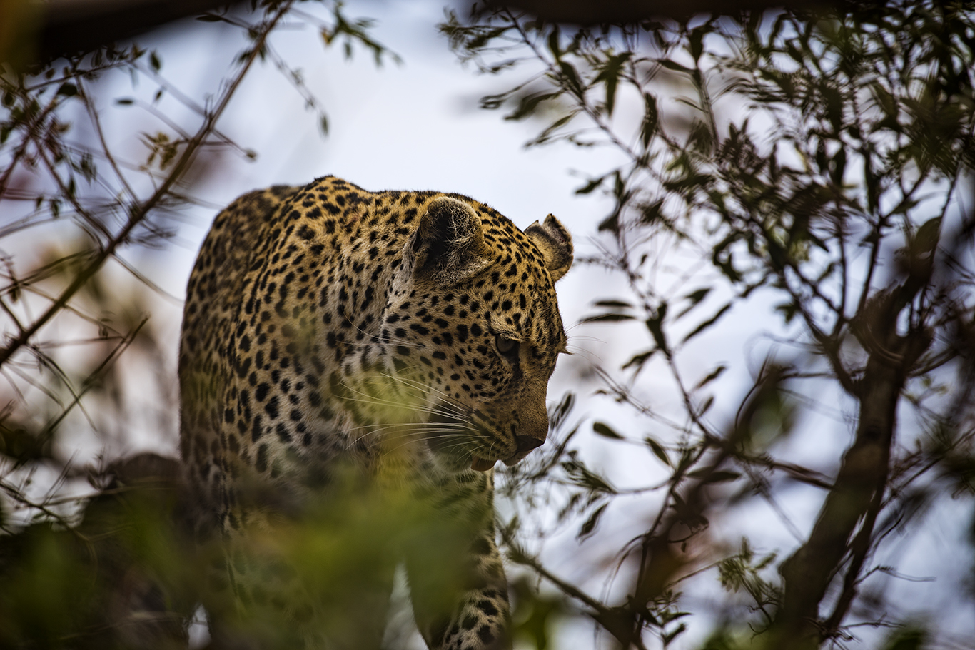
After traveling several miles, the sun creeping up ever so slowly, Jophet raises his hand, and Matt stops the jeep. He whispers to us, “There is a leopard over there on the left. He is eyeing a group of impalas several hundred yards away.” Transfixed, we watch as the leopard steals surreptitiously around the periphery, waiting to pounce when the time is right to obtain his morning meal. Before he can make his move, however, the impalas have sensed the leopard’s presence, and speed with grace and urgency out of the leopard’s purview. They are safe for now but will be on the lookout for the next predator to come calling.

_MG_2275b-TP.jpg

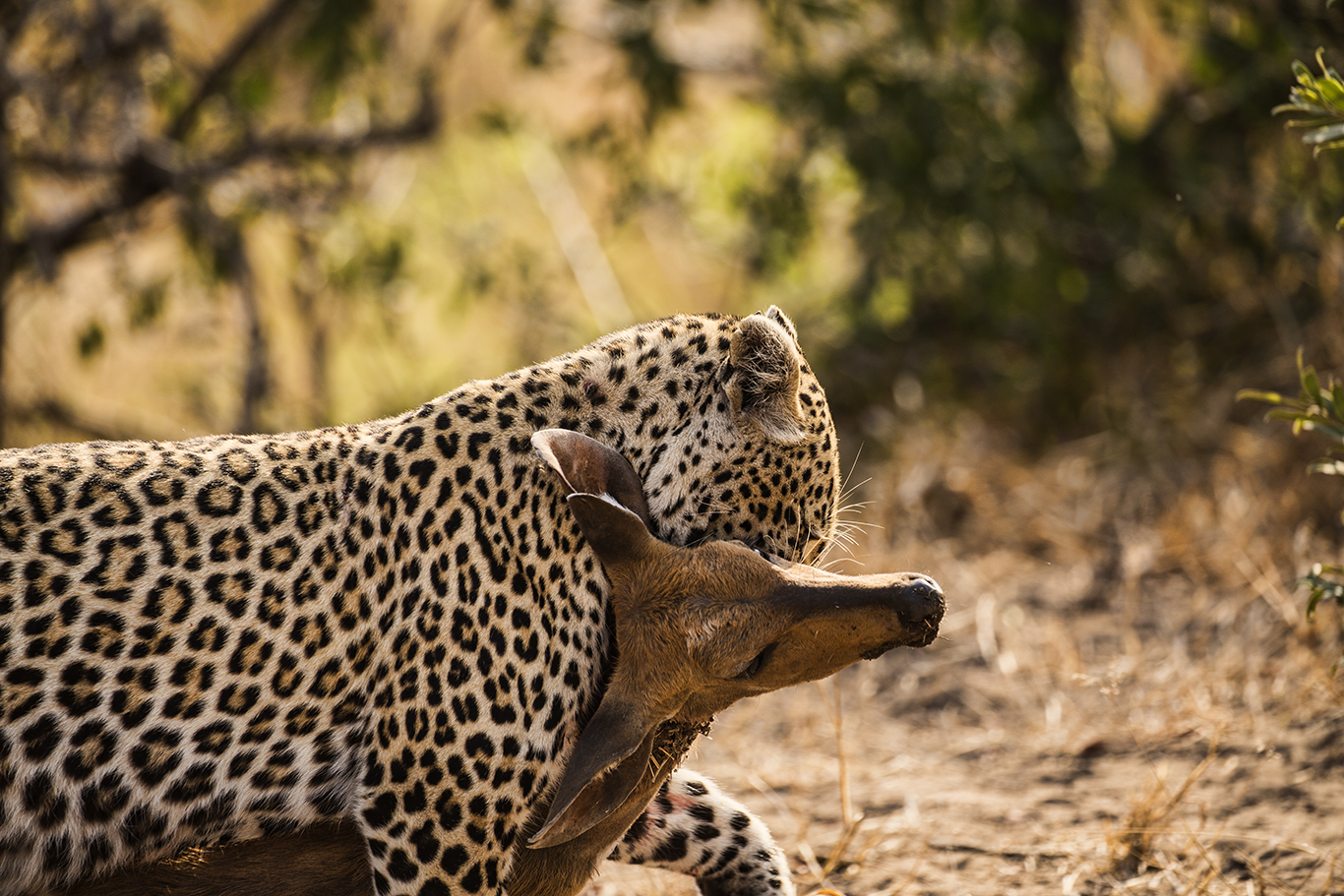
Our leopard appears undeterred. He goes back to retrieve a bush back kill that he has stashed away in a tree. This must have occurred recently, as very little of the carcass has been eaten. We watch as he carries the corpse in his teeth, presumably to an area where he will be able to consume it.

Sometimes the best-laid plans fail to materialize. The leopard does not get more than 50 yards along the path, when all of a sudden, he freezes. After several seconds, which is apparently how long it takes him to consider his options, he drops the bush back and scrambles out of sight. Matt focuses our attention approximately 50 yards to the right, where no less than a hungry hyena has come on the scene. We’re told that in the game reserve, there is a pecking order amongst the wildlife. Leopards are unable to adequately defend themselves against the brawnier hyenas, one of their natural predators.

_MG_2319b-TP.jpg

While the leopard appears sleek and elegant, especially in his normal habitat, the hyena looks to me to be a brute. He grabs the bush back carcass, carries it to a secluded spot, and proceeds to devour it. With a surgeon’s precision, he dissembles the poor bush back, not sparing any part of the cadaver. There are 2 exceptions from what I can tell. The bush back was female and apparently pregnant. The fetus is removed, and not touched again. The entrails are apparently not very appetizing and are also left on the side.

_MG_2316b-TP.jpg

Despite being mesmerized by what we are seeing, Matt points his finger towards a ledge that hovers over this scene of gluttony. Perched on the edge of the precipice, our original leopard stands motionless, watching the hyena gorge himself on what could have been his next meal.

The lesson for today is that the animal kingdom has a hierarchical chain of command. Impalas and bush backs have it tough. Leopards are crafty predators, but no match for famished hyenas. As for this human, a vegetarian lunch today would be a welcome choice.

A Day Aboard the Tranz-Alpine Train, New Zealand

A Day Aboard the Tranz-Alpine Train, New Zealand

We are now encountering grassy plateaus with multiple little hills dotting the landscape. In the distance are more mountains, partially hidden by shrouded mist. The scenery has been spectacular!

Well, we've finally reached Arthur's Pass. This is the end of the show for us, as we depart the train, and head for a van that is ready to take us to the Franz Joseph Glacier. I'll have to say, if you like the great outdoors, unspoiled by humans, the Trans-Alpine train ride is well worth experiencing! Bring your cameras.

Touring Christchurch, NZ, in the Wake of Two Recent Earthquakes

Touring Christchurch, NZ, in the Wake of Two Recent Earthquakes

We've made it to the South Island of New Zealand, and are ready to experience some of the truly awesome examples of nature in the world, including the Trans-Alpine train across the Southern Alps, Franz Joseph Glacier, Queenstown, and the fjords of Doubtful Sound. The first stop, however, is a tour of Christchurch, the site of the catastrophic earthquake of 2011, and the second quake in nearby Kaikoura in 2016. Coming from Florida, I've lived through a hurricane, which was bad enough. Seeing first hand the havoc wreaked by an earthquake, however, is very unsettling.